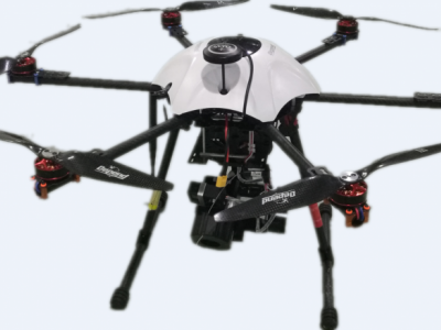
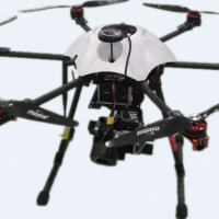
D5K6 无人机是一款基于电力设备巡检的无人机探测平台。其采用多旋翼无人机载体、可见光相机和红外相机扫描监测电力设备,同时配备地面站系统,可将扫描图像同帧回传地面站。对工作环境危险、难以到达或环境恶劣的电力设备所在区域进行与环境温度对比扫描,排查毁损电力设备。该型无人机系统采用GPS航迹规划或遥控,并可在2km距离上实现图像同帧回传。
无人机平台参数
seline;color:#333333;font-family:'Microsoft Yahei';background:#FFFFFF;">seline;font-family:微软雅黑, 'Microsoft YaHei';background:transparent;">
seline;font-family:微软雅黑, 'Microsoft YaHei';background:transparent;">
| seline;line-height:28px;font-family:微软雅黑, 'Microsoft YaHei';background:transparent;"> seline;line-height:28px;font-family:微软雅黑, 'Microsoft YaHei';background:transparent;">机体重量:seline;line-height:28px;font-family:微软雅黑, 'Microsoft YaHei';background:transparent;"> seline;line-height:28px;font-family:微软雅黑, 'Microsoft YaHei';background:transparent;"> 机体尺寸: seline;line-height:28px;font-family:微软雅黑, 'Microsoft YaHei';background:transparent;"> 飞行载荷: seline;line-height:28px;font-family:微软雅黑, 'Microsoft YaHei';background:transparent;"> 导航模式: seline;line-height:28px;font-family:微软雅黑, 'Microsoft YaHei';background:transparent;"> 任务设备: seline;line-height:28px;font-family:微软雅黑, 'Microsoft YaHei';background:transparent;"> 速 度 域: seline;line-height:28px;font-family:微软雅黑, 'Microsoft YaHei';background:transparent;"> 高 度 域: seline;line-height:28px;font-family:微软雅黑, 'Microsoft YaHei';background:transparent;"> 定位精度: seline;line-height:28px;font-family:微软雅黑, 'Microsoft YaHei';background:transparent;"> 续航性能: seline;line-height:28px;font-family:微软雅黑, 'Microsoft YaHei';background:transparent;"> 作业距离: | seline;line-height:28px;font-family:微软雅黑, 'Microsoft YaHei';background:transparent;"> seline;line-height:28px;font-family:微软雅黑, 'Microsoft YaHei';background:transparent;"> seline;line-height:28px;font-family:微软雅黑, 'Microsoft YaHei';background:transparent;"> 5000g(全部加载seline;line-height:28px;font-family:微软雅黑, 'Microsoft YaHei';background:transparent;">) seline;line-height:28px;font-family:微软雅黑, 'Microsoft YaHei';background:transparent;"> 1000*1000*430mm seline;line-height:28px;font-family:微软雅黑, 'Microsoft YaHei';background:transparent;"> ≯1300g seline;line-height:28px;font-family:微软雅黑, 'Microsoft YaHei';background:transparent;"> GPS航迹规划/遥控 seline;line-height:28px;font-family:微软雅黑, 'Microsoft YaHei';background:transparent;"> 红外相机、可见光相机 seline;line-height:28px;font-family:微软雅黑, 'Microsoft YaHei';background:transparent;"> 水平速度0~10m/s;垂直速度0~3m/s seline;line-height:28px;font-family:微软雅黑, 'Microsoft YaHei';background:transparent;"> 0~400m seline;line-height:28px;font-family:微软雅黑, 'Microsoft YaHei';background:transparent;"> 水平≯1.0m(GPS),垂直相对≯0.5m(气压计) seline;line-height:28px;font-family:微软雅黑, 'Microsoft YaHei';background:transparent;"> 20~32min seline;line-height:28px;font-family:微软雅黑, 'Microsoft YaHei';background:transparent;"> 2km |


